The performance of transportation systems after earthquake disasters greatly impacts the rescue, recovery and restoration. To better understand the potential consequences and make plans accordingly, we are developing a multidisciplinary approach to characterize the recovery process. The integrated approach includes seismic analysis as the beginning, followed by civil structural and infrastructure analysis (buildings, bridges, pipelines, roads) under earthquake impacts. Scenario and probabilistic analysis is used to compare the outcomes under different disaster scenes and intervention strategies.

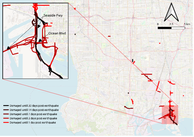
Figure 1. Simulating the traffic interruptions considering multi-infrastructure interactions post-earthquake.
Determination of Recovery Bridge Corridors by Comparing Post EQ Network
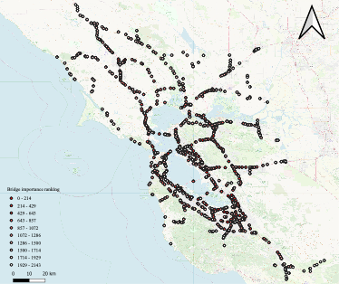
The goal is to identify simple, yet accurate, design heuristics that can be used to determine whether a bridge should be designed to a Recovery Bridge (RB) performance standard or an Ordinary Standard Bridge (OSB) performance standard. The proposed design heuristics are based on combining and ranking a set of empirical indicators or metrics derived from one-off regional traffic simulation analysis that considers a bridge’s corridor/network dependency, damage fragility/severity, and critical facility access. The validity of the proposed design heuristics will be verified by conducting numerous HPC based “earthquake, bridge damage, traffic disruptions” scenario simulations for the road networks in the San Francisco Bay Area.
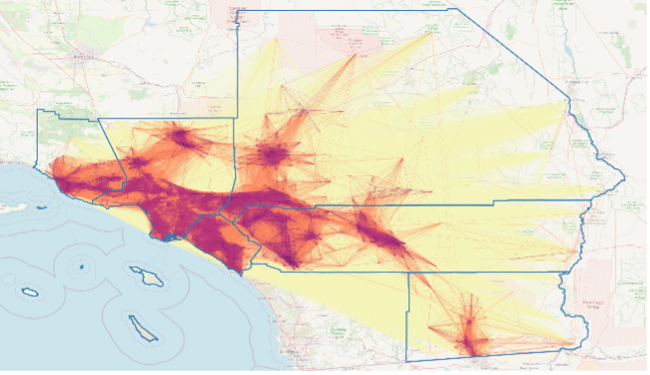
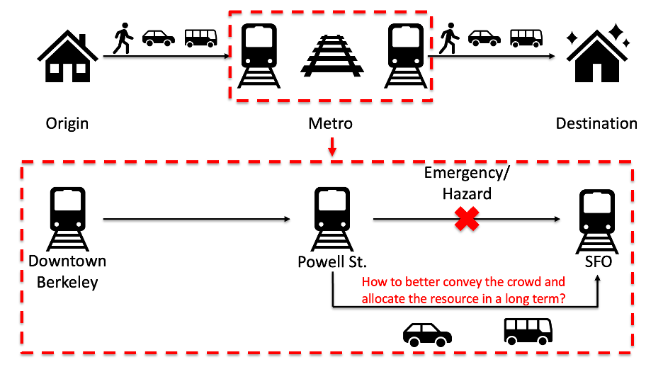
Transit Systems Vulnerability in the San Francisco Bay Area
Located on the tectonic boundary with multiple active faults, notably the San Andreas, the San Francisco Bay Area is highly vulnerable to earthquakes. United States Geological Survey (USGS) predicted that the possibility of an earthquake measuring magnitude 6.7 occurring in the San Francisco region within the next 30 years is 72%. According to experience from the past seismic events, these hazards and emergencies can greatly affect the normal operation of the transportation systems and the mobility of residents. It will be critical for the relevant transit agencies and governments to be better prepared.
As the speed and success of recovery can be enhanced with coordinated/comprehensive planning and protocols, a detailed long-term recovery plan can provide guidance to agencies and local governments to accelerate the recovery process. This multi-phase project aims develop a regionwide multi-modal traffic simulation tool to help with the planning and policy-making during the recovery stage after an earthquake.
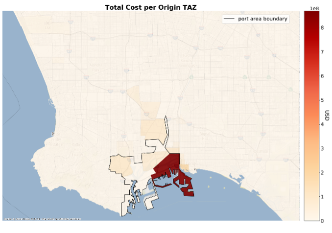
A granular framework for modeling the capacity loss and recovery of regional transportation networks under seismic hazards: a case study on the Port of Los Angeles
This project aimed to apply granular methods in bridge and traffic modeling to a regional transportation network to quantify a hypothetical earthquake’s impact to the network and its users. An image-based method is used to generate structure-and-site-specific bridge models for the Los Angeles area while a semi-dynamic agent-based traffic model is used for traffic simulation. The output from the aforementioned models is then used as input to a simple cost model to estimate direct and indirect costs to the system and its users.