The Berkeley Campus is located in the San Francisco Bay Area. This section summarizes regional geology and seismic setting of the San Francisco Bay Area and site geology of the Berkeley Campus.
Regional Geology
The San Francisco Bay Area is in the subduction zone formed by the Pacific Plate subducting beneath and creeping north against the North America Plate. The Franciscan Complex/Assemblage, a mélange dominated by sandstone, greywacke, shale, and conglomerates, is one of typical lithologies in this area. The bay mud is another distinctive characteristic and is notorious for its poor engineering properties. Figures 1 and 2 show the detailed distributions of the lithology and the bay mud.
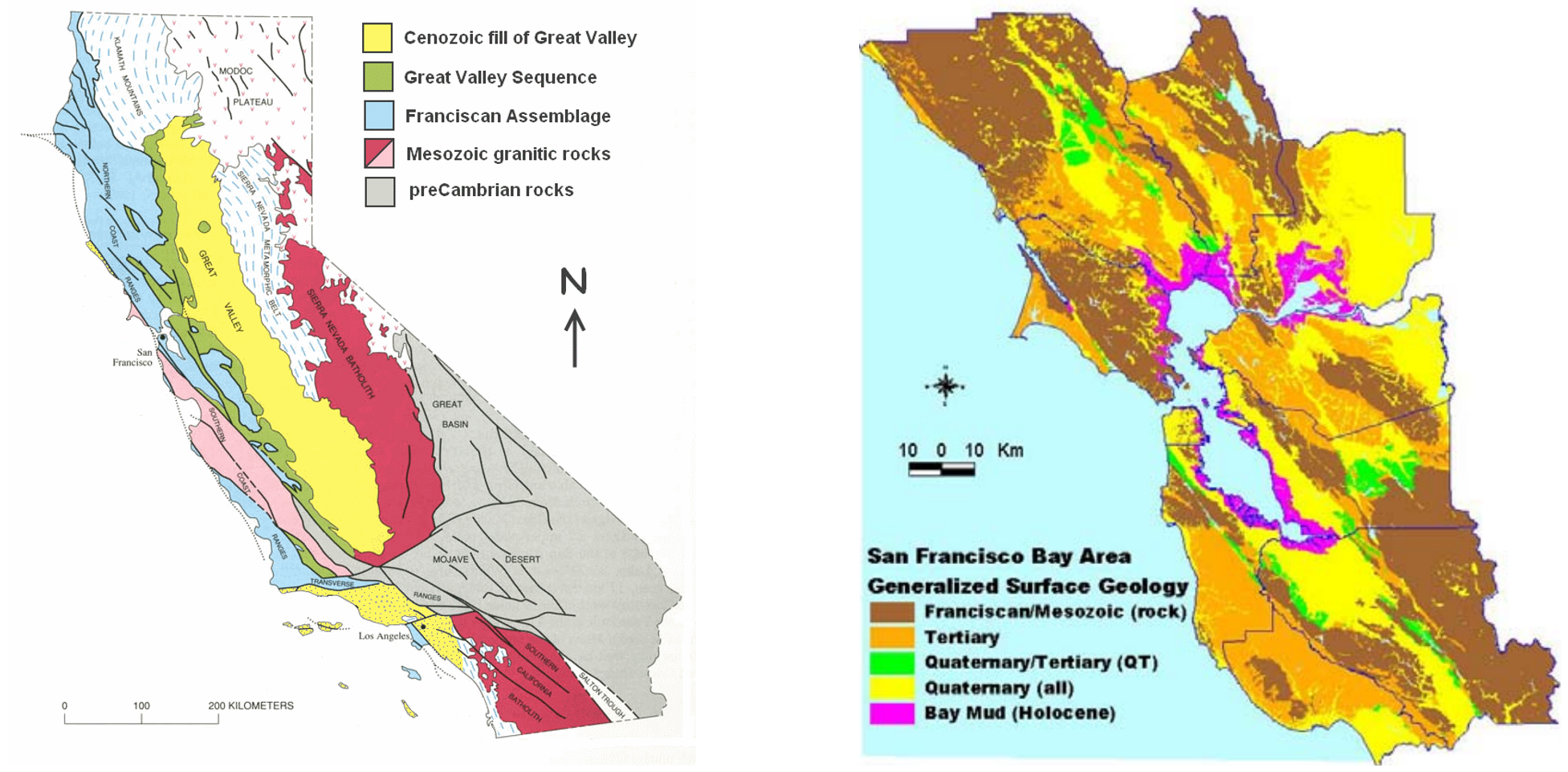
Figure 1 Lithology distribution of CA (Wikipedia) Figure 2 Distribution of Bay Mud (Silva et al. 2014)
Seismic Setting
Large earthquakes threating the San Francisco Bay Aera are primarily caused by the San Andreas fault system and its subsidiary faults. Figure 3 shows detailed distribution of fault systems in the Bay Area.
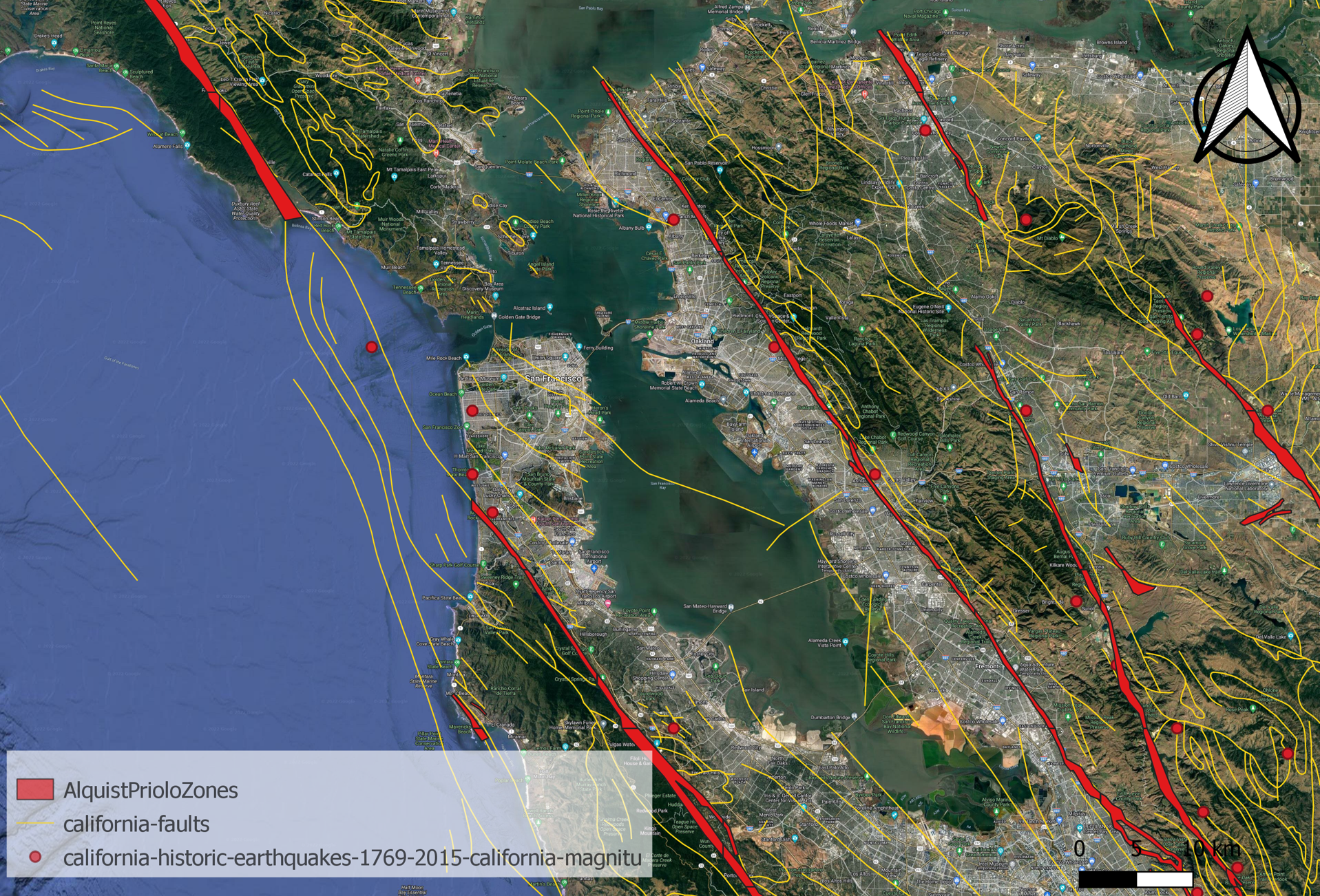
Figure 3 Distribution of water table in different seasons
Site geology of the Berkeley Campus
The UC Berkeley campus (37.87, -122.26) is located in the downtown Berkeley at the foot of Berkeley Hills, facing west to the San Francisco Bay. Based on the geological information collected, the soil profile beneath the campus is concluded as:
- Fill: loose soil with grass and sawdust, 0 to 3 feet thick.
- Upper Clay Layer: stiff to very stiff clay, 20 to 40 feet thick.
- Clay sand with gravel: medium dense sand and clayey sand, 5 to 10 feet thick.
- Bedrock: Franciscan Complex/Great Valley Sequence, very thick.
Sediments in the western and southern areas of the campus is relatively thicker (roughly 35 ft to 45 ft), while sediments in the central and northern regions of the campus is thinner (roughly 10 ft to 20 ft). The bedrock beneath the main campus (west side of the Hayward fault) is the Franciscan Complex and turns to the Great Valley Sequence on the east side of the Hayward fault.
Water table data of the Berkeley Campus is shown in figure 4, and seasonal variation can be observed. For the northwestern campus, the water table depth ranges from 4 ft to 17 ft in the Spring (rainy season) and turns to roughly 30 ft in the Fall (dry season). For the southeastern campus, the water table depth is approximately 10 ft in spring, increasing to roughly 21 ft in the summer and fall.
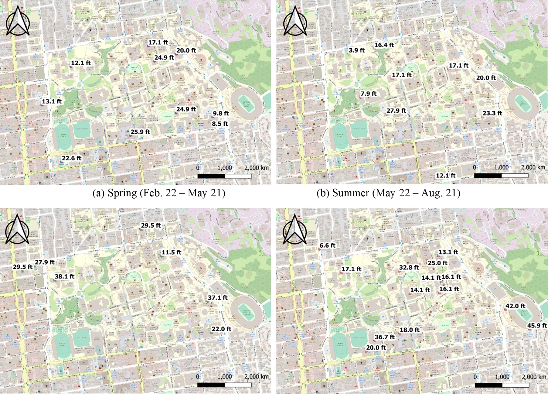
Figure 4 Distribution of water table in different seasons